Archeology
Was Atlantis Finally Found?
Was the Atlantis Capital finally discovered in the Sahara Desert? For centuries, the exact location of the mythical lost city of Atlantis has been a source of debate and speculation.

The location of the mythical lost city of Atlantis has been a source of debate and speculation for centuries. It is believed to have been destroyed by a tremendous cataclysmic flood, but its exact location has never been determined.
Atlantis, described by Plato in Timaeus and Critias

“And now, Atlantes, let us suppose, that in the great island of Atlantis there was a great and wonderful empire which had rule over the whole island and several others, and over parts of the continent; and, furthermore, that the vast power which the king of this empire gathered into his own hands was administered in such a manner as was agreeable to the will of the gods, and that he was himself of a divine nature.”
“This power came forth out of the Atlantic Ocean … an island larger than Libya and Asia put together … Now in this island of Atlantis, there was a great and wonderful empire which had rule over the whole island and several others, and over parts of the continent.”
“There were a great number of elephants on the island, and there was provision for animals of every kind, both for those who live in lakes and marshes and rivers, and also for those who live in the mountains and on the plains, and therefore for the animal which is the largest and most voracious of them.”
“A well near the central acropolis provided the city with fresh water.”
“The god Poseidon found no difficulty in making special arrangements for the center island, bringing up two springs of water from beneath the earth, one of warm water, the other of cold.”
And describe after the destruction:
“Saw only reeds on the surface of the water…”
“The sea in that area is impassable to navigation, which is hindered by mud just below the surface, the remains of the sunken island”
“Atlantis, when sunk by the earthquake, became an impassible barrier of mud to voyagers sailing from hence to any part of the ocean”
But Where the Heck was the Capital City of Atlantis?
The most popular location for Atlantis is off the coast of Southern Spain, in the Atlantic Ocean.
This is based on the writings of Plato, who wrote about the city of Atlantis in his dialogues Timaeus and Critias. According to Plato, Atlantis was a large island located beyond the Pillars of Hercules – an area that is now known as the Strait of Gibraltar.
It is thought that the city may have been located in what is now the Mediterranean Sea, off the southern coast of Spain.
Other scholars have suggested that Atlantis may have been located in the Caribbean or off the coast of Africa.
Some have speculated that the city may have been located in the North Atlantic, near the Azores Islands, a group of volcanic islands in the North Atlantic Ocean.
Others have suggested that Atlantis may have been located in the Aegean Sea, near the Greek island of Santorini (formerly called Thera).
This theory is based on the fact that Santorini is a volcanic island destroyed by a giant eruption in 1613 BC.
Why do some scholars believe Atlantis was Found in The Santorini?
The eruption of Santorini, also known as Thera, occurred around 1613 BC.
It is thought to have been one of the most significant volcanic eruptions in human history and is believed to have been the source of the legend of the lost island of Atlantis.
The eruption devastated the nearby islands of Crete and Santorini and caused significant destruction in the surrounding region.
It is estimated that the eruption had a magnitude of 6.5 on the Richter scale and was one of the most powerful volcanic eruptions ever recorded.
It is possible that this eruption could have been the cataclysmic event that destroyed Atlantis, as described by Plato in his dialogues Timaeus and Critias.
It is also possible that the remnants of the lost city could be found in the submerged ruins which have been found around the island, such as the ruined city of Akrotiri.
Furthermore, some have suggested that the Minoan Civilization, which flourished on the island of Crete, may have been the civilization of Atlantis and that the eruption of Santorini caused the destruction of both.
Why do some scholars believe Atlantis was Found off the coast of Southern Spain, in the Atlantic Ocean?
According to Plato, Atlantis was a large island located beyond the Pillars of Hercules – an area that is now known as the Strait of Gibraltar.
It is thought that the city may have been located in what is now the Mediterranean Sea, off the southern coast of Spain.
This theory is supported by the fact that many ancient cities have been found along the southern Spanish coast, such as Tartessos and the nearby Monastery of San Miguel de Arca.
It is possible that these cities were part of Atlantis or were connected to it.
Many ancient cities have been found along the southern Spanish coast, such as Tartessos and the nearby Monastery of San Miguel de Arca.
It is possible that these cities were part of Atlantis or were connected to it. Additionally, the Strait of Gibraltar is a narrow strip of water between Europe and Africa which could have been the original Pillars of Hercules described by Plato.
All of this evidence suggests that the lost city of Atlantis may have been located off the coast of Southern Spain, in the Atlantic Ocean.
Why do some scholars believe Atlantis was Founded in the Caribbean?
The theory is also supported by Plato’s writings, geography, and archaeological evidence.
Some scholars believe Atlantis was found in the Caribbean because, according to Plato’s writings, the ancient city was located near the Pillars of Hercules. This geographic marker could refer to the Strait of Gibraltar.
This, in turn, could place Atlantis in the Caribbean, as it would have been easy to travel from the Mediterranean Sea to the Caribbean by boat.
Furthermore, many islands in the Caribbean bear strong similarities to the descriptions of Atlantis given by Plato, and some of these islands even contain ancient structures and artifacts from a period that could be associated with Atlantis.
Why do some scholars believe Atlantis was founded near the Azores Islands?

This theory is based on archaeological evidence, geological data, and other clues that point to the area as the possible location of the lost paradise.
The first evidence that suggests the Azores Islands as the possible location of Atlantis is the similarity between the description in Plato’s dialogues and the islands’ geography.
The Azores consist of nine volcanic islands, some of which are surrounded by deep canyons and bays, features that are similar to the description of Atlantis given by Plato.
In addition, the Azores have been the site of numerous archaeological discoveries that may point to a possible connection with Atlantis.
In the 1980s, several artifacts were discovered on one of the islands, including a bull statue, a symbol associated with Atlantis.
Archaeologists also uncovered a temple complex on the island, which experts believe may have been used by ancient civilizations.
Geological evidence also supports the theory that Atlantis was located near the Azores.
The islands are part of the Mid-Atlantic Ridge, a massive submarine mountain range running down the Atlantic Ocean.
Why do some scholars finally believe Atlantis was founded in the Middle of the Desert?

The Blue Eye of the Sahara, also known as the Richat Structure or the Guelb er Richat, is a geological formation in the Sahara Desert that looks like a massive bullseye.
The formation stretches across approximately 14.6 miles vast region of the desert in the nation of Mauritania.
For centuries, only a few nomadic tribes in the area were aware of the formation.
It was photographed for the first time by the Gemini astronauts in the 1960s, who used it as a landmark to track the progress of their landing sequences.
Later, the Landsat satellite took additional images and provided information about the formation’s size, height, and extent.
Geologists initially thought the Eye of the Sahara was an impact crater formed when a space object collided with the surface.
However, long-term studies of the rocks inside the structure show that its origins are entirely Earth-based.
Tourists and geologists flock to the Eye of the Sahara to study the unique geological feature in person.
However, because the Eye is located in a sparsely inhabited region of the desert with very little water or rainfall, it is not under much threat from humans.
Reasons Why the Capital City of the Atlantis was in the Eye of the Sahara?
Plato and Solon were known to have integrity and were rarely challenged. Plato’s story of Atlantis is the only one that has ever been challenged.
Herodotus (484–425 BC) was an ancient Greek historian and geographer known for having written the Histories – a detailed account of the Greco-Persian Wars.

He created a detailed inhabited world map placing Atlantis on the western Sahara Desert, south of Mount Atlas.
Herodotus’s map from 450 BC places Atlantis in the same place as the Eye.
Another map, Pomponius Mela, Rome’s first geographer, created a sophisticated map of the known world titled “Del Sito, Forma E Misvra Del Mondo” 2000 years ago (The Habitable World of Pomponius Mela). He was placing Atlantis in the exact location.

Atlantis was described as having impressive mountains to the north.
The massive mountain chain to the north is called the Atlas Mountains,, which were aptly named after the first known king of Mauritania, who shares the same name as the very first king of Atlantis, Atlas.
The first documented usage of the term “Atlantic” was in the sixth century BC by a Greek poet, Atlantikôi pelágei, or the “Sea of Atlas.”
The nearby mountains were revered as Gods’ representatives, with lush rivers and waterfalls. These mountains were said to be in the north, where the Eye’s mountains are. When you look at the satellite images of the Eye, you can see the river and water lines that appear throughout the landscape.
Plato described the sea to the south of Atlantis and the desert surrounding it, which can also be seen in satellite images.
The legend of Atlantis is based on ancient Egyptians, that claimed that they were colonists and the last survivors of a civilization that was destroyed in a cataclysm.
We learned about Atlantis and its precise location through their ancestors.
The diameter of the Capital City of Atlantis’ circular isle was described as 127 Stadia. 1 Stadia equals 607 feet. When you multiply 127 x 607, the result is 77,089 ft. This is approximately 14.6 miles – the diameter of the Eye.
Solon, Plato’s relative, was an Athenian statesman and poet who traveled to Egypt and learned about Atlantis first-hand. These are the stories that Solon told Plato.
In his Critias and Timaeus dialogues, Plato describes Atlantis as three alternating zones of water and two of land, which could easily be transposed onto the physical structure of the Eye that we know today.
It was said that fresh water flowed from Atlantis’ center island, which also exists in the Eye’s center circle.
Satellite imagery shows that weather pushed mud across the region, which could easily be attributed to a tsunami, one of many aspects of the weather system that destroyed Atlantis simultaneously.
Mauritania exports copper and gold, both of which were abundant throughout the Atlantean Empire.
Plato claimed that elephants and other animals were plentiful on Atlantis; many elephant bones have been discovered near the Eye.
Black, red, and lighter-colored rocks were said to be embedded throughout Atlantis. This also applies to the Eye.
Thousands of artifacts have been discovered in and around the Richat Structure. Most are 12,000 years old or older, putting them in the same time frame as Atlantis. Arrowheads, spears, stone spheres, surfboards, oars, ship hulls, and other items are among them.
The center of the city of Atlantis, described as being geothermal, was said to have been blessed with hot springs and freshwater springs, as defined by Plato.
A little-known study of the Rishad structure from the late 1990s describes it as a hydrothermal complex.
Hot springs are the very definition of a hydrothermal anomaly, and the fact that there is an actual scientific study corroborating this uniquely specific characteristic is remarkable.
Sahara was a lush green tropical landscape at the time of Atlantis. But between 8,000 and 4500 years ago, it transitioned from humid to dry, resulting in the Sahara Desert.
Considering that all of the areas in and around the wrist shot have concentrations of salt and are in the areas of the lowest elevation, it seems reasonable to conclude that seawater had once settled and evaporated there.

What is your opinion, is the eye of the Sahara the most likely location for the lost capital of the City of Atlantis?
More information about the 1998 Capão Redondo UAP Incident
Archeology
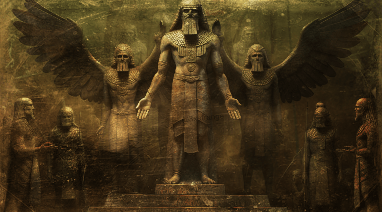
The Anunnaki: Ancient Aliens in the Bible?
The Anunnaki are a group of deities who are mentioned in Sumerian mythology. They are said to have come from a planet called Nibiru and are credited with creating humanity. Some people believe that the Anunnaki are actually aliens and that they visited Earth thousands of years ago.
The Anunnaki are a group of deities who are mentioned in Sumerian mythology. They are said to have come from a planet called Nibiru and are credited with creating humanity. Some people believe that the Anunnaki are actually aliens and that they visited Earth thousands of years ago.
The evidence for the existence of the Anunnaki is mainly circumstantial. There are no physical remains of Nibiru, and there is no scientific consensus on whether or not aliens have visited Earth.
However, some ancient texts mention the Anunnaki, and there are several similarities between Sumerian mythology and modern UFO stories.
One of the most famous pieces of evidence for the existence of the Anunnaki is the Enuma Elish, a Babylonian creation myth.
The Enuma Elish tells how the Anunnaki came to Earth and created humanity. According to the Enuma Elish, the Anunnaki were originally gods who lived in the heavens.
However, they became tired of living in the heavens, so they decided to create a new world where they could live.
They created Earth, and they created humanity to work for them.
The Enuma Elish is just one of many ancient texts that mention the Anunnaki. Many ancient artifacts depict the Anunnaki. One of the most famous artifacts is the Gudea Cylinder, a Sumerian clay cylinder representing the God Ningishzidda, often identified with the Anunnaki.
The similarities between Sumerian mythology and modern UFO stories are also striking. In both cases, there are stories of aliens who come to Earth from a distant planet.
In both cases, the aliens are said to be taller and more intelligent than humans. And in both cases, the aliens are said to impact human culture profoundly.
Of course, the similarities between Sumerian mythology and modern UFO stories could be coincidental. However, it is also possible that the similarities prove that Anunnaki is real. If the Anunnaki did visit Earth thousands of years ago, they left behind stories and artifacts passed down through the generations.
The possibility that the Anunnaki are accurate is an exciting one. It would mean that we are not alone in the universe and that our history is much more complex than we ever imagined.
If you are interested in learning more about the Anunnaki, do some research on your own. There are some books and websites that can provide you with more information.
The Evidence for the Anunnaki
The evidence for the existence of the Anunnaki is mainly circumstantial. There are no physical remains of Nibiru, and there is no scientific consensus on whether or not aliens have visited Earth.
However, many ancient texts mention the Anunnaki, and some similarities exist between Sumerian mythology and modern UFO stories.
One of the most famous pieces of evidence for the existence of the Anunnaki is the Enuma Elish, a Babylonian creation myth.
The Enuma Elish tells how the Anunnaki came to Earth and created humanity. According to the Enuma Elish, the Anunnaki were originally gods who lived in the heavens. However, they became tired of living in the heavens, so they decided to create a new world where they could live.
They created Earth, and they created humanity to work for them.
The Enuma Elish is just one of many ancient texts that mention the Anunnaki. Some ancient artifacts depict the Anunnaki.
One of the most famous artifacts is the Gudea Cylinder, a Sumerian clay cylinder representing the God Ningishzidda, often identified with the Anunnaki.
The similarities between Sumerian mythology and modern UFO stories are also striking. In both cases, there are stories of aliens who come to Earth from a distant planet.
In both cases, the aliens are said to be taller and more intelligent than humans. And in both cases, the aliens are said to impact human culture profoundly.
Of course, the similarities between Sumerian mythology and modern UFO stories could be coincidental.
However, it is also possible that the similarities prove that Anunnaki is real. If the Anunnaki did visit Earth thousands of years ago, then it is possible that they left behind stories and artifacts passed down through the generations.
The Anunnaki and the Bible
Some people believe that the Anunnaki are mentioned in the Bible. In the book of Genesis, it is said that God created man in his image.
However, some people believe that this passage is referring to the Anunnaki.
They believe that the Anunnaki created humanity in their image and that they are the ones who taught us the knowledge that we have today.
Some passages in the Bible could be interpreted as references to the Anunnaki. For example, in the book of Ezekiel, it is said that there were “cherubim” who were “like the sons of men.”
Ezekiel 1:5: “As I looked, I saw a stormy wind coming out of the north—a great cloud with flashing lightning and surrounded by brilliant light. The center of the cloud was glowing like glowing metal, and in the center of the fire was something like four living creatures. In appearance their form was human, 6 but each of them had four faces and four wings. 7 Their legs were straight, and their feet were like the feet of a calf and gleamed like burnished bronze. 8 Under their wings on their four sides they had human hands. All four of them had faces and wings, 9 and the wings of one touched the wings of the creature on either side. Each one went straight ahead; they did not turn as they moved.”
Ezekiel 10:14: “Each of the cherubim had four faces: One face was that of a cherub, the second the face of a human being, the third the face of a lion, and the fourth the face of an eagle.”
In both of these passages, the cherubim are described as having human-like features, such as faces and hands. However, they also have animal-like features, such as wings and the faces of lions and eagles. This combination of human and animal features is characteristic of cherubim in the Bible.
The meaning of the cherubim in Ezekiel is not entirely clear. Some scholars believe that they represent the presence of God, while others believe that they represent the four gospels.
Some people believe that these cherubim are references to the Anunnaki.
Of course, there is no scientific consensus on whether or not the Anunnaki are mentioned in the Bible. However, it is an exciting possibility to consider. If the Anunnaki are accurate, then it would mean that they have been involved in human history for a long time.
The Anunnaki and Modern UFO Stories
As mentioned earlier, there are several similarities between Sumerian mythology and modern UFO stories. In both cases, there are stories of aliens who come to Earth from a distant planet.
In both cases, the aliens are said to be taller and more intelligent than humans. And in both cases, the aliens are said to impact human culture profoundly.
Some people believe that these similarities are evidence that the Anunnaki are real. They believe that the Anunnaki are still visiting Earth today and that they are the ones who are responsible for the modern UFO phenomenon.
Of course, there is no scientific evidence to support this claim. However, it is an exciting possibility to consider.
If the Anunnaki are accurate, then it would mean that they are still involved in human history.
Conclusion
The Anunnaki are a fascinating and mysterious group of beings. There is no scientific consensus on whether or not they are real, but much evidence suggests that they may be.
If the Anunnaki are accurate, then they have a profound impact on human history.
They may have created humanity, they may have influenced our culture, and they may still be visiting Earth today.
I encourage you to do some research on the Anunnaki for yourself. Many books and websites can provide you with more information.
If you want to learn more about the possibility of extraterrestrial life, then the Anunnaki are an excellent place to start.
References
Archeology
Learn The Truth About The Giant Pharaoh
In the early 1900s, a British archaeologist discovered a large mastaba belonging to a Giant Pharaoh near Girgeh in Upper Egypt,
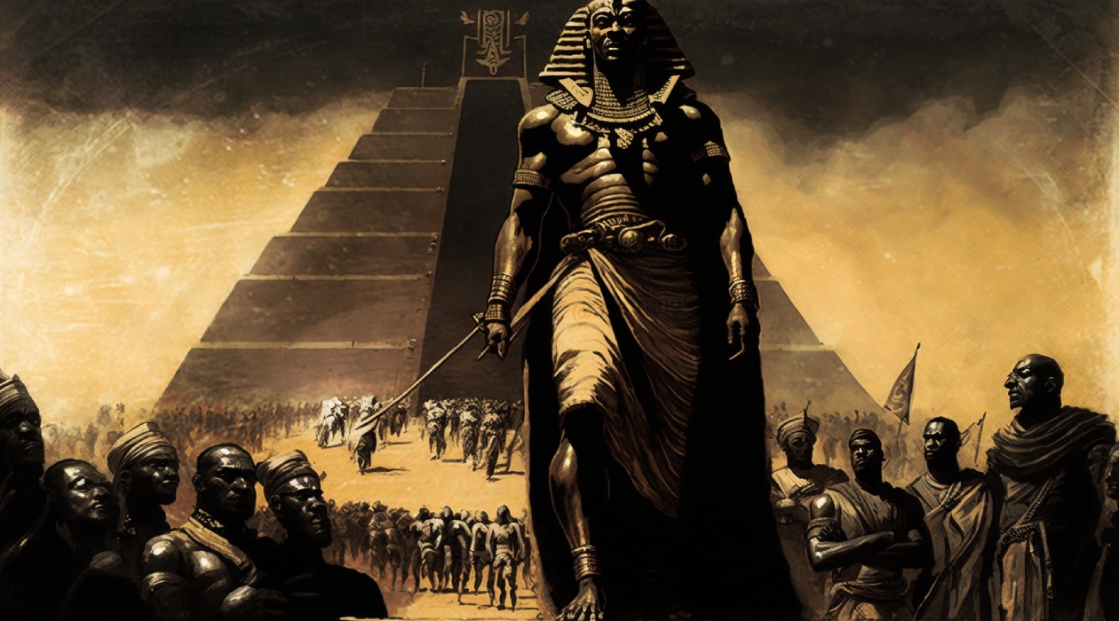
In the early 1900s, a British archaeologist, John Garstang, made a groundbreaking discovery near Girgeh in Upper Egypt, a large mastaba belonging to a Giant Pharaoh.
Among the finds were relief fragments bearing the name of an unknown pharaoh at the time, Sanakht.
But who was the archeologist that found the Giant Pharaoh?
John Garstang was a prominent British archaeologist who lived from 1876 to 1956.
He is known for his work in the Middle East, particularly in the regions of Palestine, Syria, and Turkey.
Garstang began his career as an assistant at the Egypt Exploration Fund and later worked as a professor of archaeology at the University of Liverpool.
Garstang’s work was instrumental in developing archaeology in the Middle East, and he is remembered today as one of the most influential figures in the study of ancient Near Eastern civilizations.
In 1901 John Garstang made a groundbreaking discovery of Sanakht’s Mastaba near Girgeh in Upper Egypt.
What was found in the Mastaba K2?
Among the artifacts found in the Mastaba were fragments of a red granite sarcophagus and a limestone funerary stela, both bearing Sanakht’s name.

Relief fragment of Pharaoh Sanakht, third dynasty, circa 2670 BC. Sanakht is shown in the pose of smiting an enemy. Originally from Serabit in the Sinai.
The stela depicts the Pharaoh offering to several deities.
It includes an inscription describing Sanakht as “The one who unites the Two Lands” (Upper and Lower Egypt).
The Giant in the Mastaba
Archaeologists also found the remains of a man inside the tomb, but something was unusual about them.
Upon close examination, they found that the bones were large.
The skeletal remains were over 1.87 m (6′ 1″) tall, making him 20 cm (7.87″) taller than the average of prehistoric and later Egyptians.
Even taller than Ramses II, who was only 175 cm (5’8″).

Presumably, Sanakht’s skull was found in his Mastaba near Girgeh in Upper Egypt.
Who was the Pharaoh Sanakht?
Pharaoh Sanakht (also spelled Nebka or Hor-Sanakht) was a king of the Third Dynasty of ancient Egypt who ruled around 2700 BCE.
Sanakht’s reign was relatively short, and his role in Egyptian History needs to be more well-known.
He is believed to have been the successor of Pharaoh Djoser, who was known for commissioning the first pyramid in Egypt at the site of Saqqara.
The Saqqara contains the oldest complete stone building complex known in History.
A mastaba (a type of ancient Egyptian tomb) at Saqqara has been identified as possibly belonging to Sanakht.
But Sanakht was really a giant, or exist another explanation?
Francesco M. Galassi, from the University of Zurich, and his colleagues believe Sanakht’s unusual height resulted from gigantism.
Other earlier skeletons have been diagnosed with acromegaly, while both acromegaly and gigantism have a similar cause.
Acromegaly occurs in adulthood, and gigantism happens in childhood.
Gigantism is an extremely rare condition that happens when a child or adolescent has high levels of growth hormone in their body, which causes them to grow very tall.
The bones were found buried with honors in an elite tomb.
But usually, gigantism was associated with social marginalization in ancient times, including in Egypt.
However, a new analysis found that Sanakht was not suffering from the condition.
He was simply a remarkably tall man.
What was Sanakht’s Origin?
Scholars have suggested that the proportions of Sanakht’s long bones indicate an affinity with people of sub-Saharan African ancestry.
Some archeologists support that Pharaoh Sanakht was of Nubian (South Sudanese) origin, which would explain his height.
Who were the Nubians?
Archaeological evidence suggests that the Nile Valley, including the region that is now South Sudan, was inhabited by humans as early as the Paleolithic period (over 2 million years ago).
Over time, various groups migrated to the region, including the Nubians and other ethnicities from the neighboring areas.
The Nubians, who inhabited the Nile Valley in what is now northern Sudan and southern Egypt, had a significant influence on ancient Egyptian culture and History.
The Nubians and Egyptians interacted extensively throughout their shared History, exchanging goods, ideas, and cultural practices.
The Nubians were known for their skill in agriculture, metalworking, and trade, and they established many powerful kingdoms in the region, including the Kingdom of Kush.
Why is South Sudan people tall?

The people of South Sudan are known for their exceptional height, with an average male height of approximately 6 feet 2 inches, making them the tallest people in the world.
This is a striking contrast to the global average male height of around 5 feet 7 inches.
The reasons for this remarkable height are complex and multifaceted but may be related to genetic and environmental factors.
One possible explanation for the tall stature of the South Sudanese people is genetics.
Recent studies have identified some genetic variants that appear to be associated with increased height, and some of these variants may be more common in the South Sudanese population.
It is also worth noting that the people of South Sudan are a highly diverse group with a wide range of ethnicities and cultural backgrounds, and genetic and environmental factors may differ between these groups and contribute to differences in height.

Another factor that may contribute to the exceptional height of the South Sudanese people is their environment.
The region is characterized by high levels of sunlight and heat, which may promote the growth of long bones.
Additionally, the traditional diet of the South Sudanese people is rich in protein and other nutrients that are essential for growth and development, which may also contribute to their impressive stature.
Today, the Dinka people are the tallest in Africa and are of South Sudanese origin.
They have an average height of 6 feet, or 1.83 meters, for men and 5 feet, 10 inches, or 1.78 meters, for women.
Pharaoh Sanakht’s stature was related to genetic or environmental factors.
The exceptional height of the South Sudanese people offers a possible explanation for the Gian Pharaoh’s remarkable physical characteristics.
Discover more giants thru the History.
In Greek mythology, there were the Titans, a race of powerful and god-like beings who were said to have once ruled the world.
Similarly, in Norse mythology, there was the Jotun, a race of giants who were often portrayed as enemies of the gods.
There are several references to giants in the Bible, particularly in the Old Testament.
One of the most well-known accounts is the story of David and Goliath, where the Philistine Giant Goliath is said to have been over nine feet tall (1 Samuel 17:4-7).
The Nephilim, a group of beings described as the offspring of the “sons of God” and the “daughters of men,” is also mentioned in Genesis 6:4 and often interpreted as giants.
More information about The Giant Pharaoh
Archeology
What you know about the Unicorn is Wrong
What you know about the Unicorn may need to be corrected. What if I tell you Unicorn is or was a real animal as described in the Bible?

What you know about the Unicorn may need to be corrected. What if I tell you Unicorn is or was a real animal as described in the Bible?
Like many other world religions and mythologies, the Bible contains stories of extraordinary creatures.
In the Old Testament, we find mentions of beings such as Unicorns, the Behemoth, the Leviathan, the Nephilim, and Giants.
These creatures have captured people’s imaginations for centuries, and their potential origins are as unbelievable as their descriptions.

One of the creatures found in the Old Testament is the Unicorn.
What really is a Unicorn?
Surprisingly, it is mentioned quite a few times in the Bible.
In the Book of Numbers, the Bible describes God as a unicorn, stating:
“God brought them out of Egypt; he hath as it were the strength of an unicorn.”
– Numbers 23:22
“God brought him forth out of Egypt; he hath as it were the strength of an unicorn: he shall eat up the nations his enemies, and shall break their bones, and pierce them through with his arrows.”
– Numbers 24:8
The Deuteronomy:
“His glory is like the firstling of his bullock, and his horns are like the horns of unicorns: with them he shall push the people together to the ends of the earth: and they are the ten thousands of Ephraim, and they are the thousands of Manasseh.”
– Deuteronomy 33:17
In the Book of Job, God rhetorically asks
“Will the unicorn be willing to serve thee, or abide by thy crib? Canst thou bind the unicorn with his band in the furrow? or will he harrow the valleys after thee?”
– Job 39:9-10
In Psalm:
“Save me from the lion’s mouth: for thou hast heard me from the horns of the unicorns.”
– Psalm 22:21
“He maketh them also to skip like a calf; Lebanon and Sirion like a young unicorn.”
– Psalm 29:6
“But my horn shalt thou exalt like the horn of an unicorn: I shall be anointed with fresh oil.”
– Psalm 92:10
However, in the original Hebrew Bible, the creature is not called a unicorn but “Re-em.”
But what is a Re-em?
When the Greeks began translating the Bible, they translated the Hebrew word “Re-em” to “Monokeros,” Mono (single) Keros (Horn), which means one horn.
Similarly, the Latin speakers translated the word “Unicornis,” from which we get our word unicorn.
However, the Greeks and Romans did not feature unicorns in their mythologies.
Instead, they are featured in ancient Greco-Roman natural encyclopedias.
These ancient nature textbooks did not think unicorns were mythical beasts but real-life creatures as natural as a cow, lion, or horse.
Some scholars believe it is a case of mistaken identity, and the one-horned creature is a Rhino.

When early travelers went to faraway lands, they spoke of strange creatures they saw on their way.
For example, the Roman naturalist Pliny the Elder describes a creature as fierce animal called the Unicorn, which is the head of a stag, the feet of an elephant, and the tail of a bull, while the rest of the body is like a horse.
Scholars believe Pliny offers an imperfect and simplistic description of a rhino.
He likely heard a second or third-hand description of one and is recounting it in his book.
The definition of the unknown creature became distorted, with each telling a bit like a game of telephone.
Another possibility for the Unicorn’s identity?
The original description of a rhino may have been distorted when it first got translated.
Another explanation for the unicorn’s identity is that the Hebrew word for the unicorn, “Re-em,” actually means a creature similar to the “Rimu” animal that the nearby Acadians called the “Aurochs,” an ancient ancestor of modern-day Cattle.
Therefore, when the Bible talks about unicorns, it may refer to an ancient Bull type.

If initially, the Bible described the Unicorn as a Bull or a Rhino, I’ll let you decide.
More information about the 1998 Capão Redondo UAP Incident
-

 Ghost10 years ago
The Strange Real Story Behind The Busby Stoop Curse
-

 UFO3 years ago
The 1966 Tully Saucer Nest
-

 Paranormal10 years ago
1954 Greada Treaty – President Eisenhower form a treaty with aliens at Holloman AFB
-
Ghost16 years ago
Whatching ‘Phoonk 2′ can fetch you U$10,000
-

 UFO8 years ago
The Guyancourt UFO Incident – When Two UFOs Landed for Repair
-

 Paranormal10 years ago
Did the Red Baron shoot down an UFO during WWI?
-

 Archeology3 years ago
What you know about the Unicorn is Wrong
-

 True Crimes8 years ago
What You Should Know About Elisa Lam Will Scare You
-

 Cryptozoology9 years ago
Was Azzo Bassou the Missing Link?
-

 UFO9 years ago
Understand The Truth About Phil Schneider and The Dulce Base
-

 Amazon9 years ago
The True Story of The Amazons, The Real Wonder Woman from Amazon
-

 Debunk9 years ago
The Philip Experiment – The Strange Story Behind the Movie The Quiet Ones
-

 Ghost9 years ago
Ghosts, Murders and Suicides From Hotel Cecil to Stay On Main Hotel
-

 UFO4 years ago
The 18th Century Alien Abduction you didn’t know
-

 Paranormal10 years ago
When UFO Attacks – The Facchini Incident
-

 Archeology3 years ago
The Anunnaki: Ancient Aliens in the Bible?
-

 UFO5 years ago
The Ubatuba Incident – A UFO Exploded in 1957 with Fragments?
-

 UFO4 years ago
What Really Happened to the family in the Caiana UFO Abduction
-

 True Crimes8 years ago
Christmas Massacre – The real story of Bloody Bob Sims
-

 Cryptozoology10 years ago
What No One Tells You About The Van Meter Visitor
You must be logged in to post a comment Login